10/21/18

Moving Along the Road to Ruins

[September 12, 20180]
As we again realize the absence of easy connectivity and relax into the enjoyment and amazement of exploring by camper van Quiggy, blog dates diverge from real time.

Our second day at Mesa Verde begins with a tour of Cliff Palace.  The sun bleached photo shows the expansive nature of the cliff house - with a tour group of 50 at the bottom left for size comparison. 

We learn that the construction may have occurred over years - and that the masonry skills varied by builders.  Or maybe it is the styles that vary.  Some corners are precisely and beautifully square.  Some walls flow in shape to match a cave wall or  the curve of a heavy boulder.  It's thought that the Ancestral Puebloans lived here from about 600 - 1300; and we hear many reasons why they may have moved on.  The best insight may be as told by their descendants: it was time to move on. They also say that the ancestors still return here to visit, which is why i'm including my sun-ray- draped photo.  It seems appropriately ghostly.

After the tour we drive the mesa loop peering over the cliff edge at other dwellings that are not open for park visitors.  Binoculars are helpful for getting a view across the valley and inside the buildings.  Rangers tell us that some of the people lived on the mesa tops where the farming work was done. 

All of the cliff dwellings we visit have storage areas constructed to be safe from rodents and other hungry visitors, so the traffic up and down the cliff edges must have been steady. The food storage areas are usually in an upper level room - often tucked into a ledge above the living areas.

The tower makes it possible to almost reach the storage area. 

Our evening tour is Long House.  Like Cliff Palace it seems designed for a sizable group - and the tour group is also sizable.  We follow an earlier recommendation to bring along our bikes to ride the 5 mile loop to see other ruins on the mesa top after we drag ourselves back up and over the cliff edge.


By the time we complete the bike ride and tour we feel the value of spending time high in the Rockies before coming to Mesa Verde.  This elevation is >7,000 feet.  Those extra RBCs are working well distributing Oas needed.

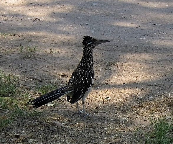
The first people must have been incredibly fit farmers, climbers, builders, and artists.


9/23/18

An Owl is the Eagle of the Night


On to Mesa Verde National Park...a park where you can easily find a camp site if you don’t require electricity or water. And there are free showers near the camp store. As soon as we find our campsite in the Apache Loop, we’re off along Chapin Mesa to see Balcony House. On the way we stop by Far View House. Far View is on an elevated area where the two mesas split and the view is forever in all directions.


The rangers tell us that the tours go on all day but that timing will make the hikes easier: east facing in the afternoon, west facing is fine for morning. The ruins can be toured only with a ranger-guide so we meet Ranger David Night Eagle - a blue eyed descendant of The Lakota to tour Balcony House. He is partly comedian-entertainer and partly knowledgeable park ranger. His name translates to “owl”.

He warns that a fear of heights could make it impossible. The narrow ledge he describes gives me pause, but he adds that he typically leans out over the protective fence to display its safety. 


It turns out to be an amazing construction - easy to imagine people living here in the coolness of the cave. There is a seep spring in the back of the cave that still provides water. We’re asked not to touch walls or anything else without permission. If we faint, we must just lower ourselves to the ground without grabbing anything for support. We see hand and toe holds used by the people to climb in and out of the dwelling. We are allowed to grip the ladder edges as we climb. They are in the style of the time, but not original.

At the conclusion of the tour he reveals that the item he has been carrying over his shoulder in the insulated bag is one of many flutes that he has made. He plays for us...not for us...but for the ancient ones whose spirits continue to visit this place.


[Video and photo credit: Alex]


9/22/18

Last Dollar And Cute Shoes


[Sept 10th]

We head west to drive the Alpine Loop Rd through Cinnamon Mt pass (12,640 ft elevation).

At the top another traveler comments, “You made this drive in a van?” - as if we deserve to slip off the top all the way to the canyon bottom for being so naive. Perhaps it is selective attention and she sees only Q’s big white side. 

In my imagination any of the other many Q admirers comes along at that moment and says, “What an amazing vehicle! It’s lifted? Four-wheel drive and low range too? Big tires - and it must turn on a dime. And you brought your bikes, too? Where’s the boat? Oh - it’s up there with the solar panels?”
After moving on, in my mind as well, we re-inflate the tires and unlock the hubs, and enjoy the ride to Silverton on the scenic paved road. The scenic nature is sometimes interrupted with remnants of mining, like this gondola across the deep canyon.


Our route takes us back north to Ouray and then Ridgway so that we can drive the Last Dollar Road and find a peaceful and beautiful back country camp site.


Last Dollar Rd below Ridgway, CO


View from our campsite (Telluride to the southeast)
Last Dollar Rd ends near Telluride - a city that looks just great after the big film festival last week. Breakfast here is surprisingly yummy, quick, and inexpensive. The little restaurant is eat-here-or-take-out. 

The sign in the restroom seems appropriate for this land of tolerance and understanding. Instead of asking that we not flush any trash... it suggests that “an overflow might ruin those cute shoes you’re wearing.” 

And these cute shoes are quickly on the way towards Cortez and Mesa Verde.

We stop at the Anasazi Heritage Center to re-center our focus on petroglyphs, pictographs, and ancient ruins. 

The Escalante Ruins are right on the museum site. Helpful signs along the walk describe native plants and the uses made by the people. Skunk Sumac, Gamble Oak, Mountain Mahogany, Pinyon Pine, Sage Brush, Juniper, Fenderbrush, and Yucca all have generous descriptions of medicinal or nutritional uses. The Service Berry sign has only a pie recipe, leaving us a bit uncertain if the recipe originated with ancient Puebloans or if the sign-maker just loves pie.


9/09/18

From Hannibal to Alpine Loop Fall 2018

It’s Tuesday & we’re off at 9:10 am, 10 minutes behind our so-called schedule. We say “oh well” as we head west through MI, IN, IL, and into MO. Our first night destination is Hannibal MO, but we continue on to a campground near Macon - the Long Branch State Park. It is remarkable to see the park so clean after the long Labor Day weekend.

It is hot (80+ degrees) with a forecast for 73 near 4 am. We select site #70 with an electrical hook up so that we can use fans and give the solar storage batteries a rest, running the refrigerator off camp power. It lets us use our little fan too.


[Saturday] It is now day 5 of this trip. In the meantime we drove across Kansas and into Colorado finding the Bonny Lake campground gone. The only guests were hungry mosquitos and goat head stickers. A KOA experience is our lot. The tenting part of the campground is pretty quiet.

After a couple of days checking up on some feisty old relatives (only slightly older than we are), we head for the Rocky Mtns. Our camp is Lottes Creek Camp which we reach via Cumberland Pass. Letting a little air out of the tires makes the bumpy dirt-rocky road just fine.


Colorado Rocky Mt. blue sky

[Sunday] Today we drive through Gunnison and then south to find the Alpine Loop Road. The drive is as beautiful as you imagine.


The campsite views along the Lake Fork of the Gunnison River are stunning.

9/03/18

Faded Love in Turkey Texas

Late Blog Post from Late April 2018

Nearly 3 months ago we camped at a sweet spot in Palo Duro Canyon not far from Amarillo.  Flowing by our campsite was the Prairie Dog Town Fork of the Red River.  If you happen to be that one blog reader who remembers (time warp factor) you'll see the satisfying circle back to land carved by that little river fork.  We're about 80 miles southeast - that is a lot of carving. 
Now on our journey towards home we are southeast of the Red River in a beautiful escarpment carved certainly for our delight.  Caprock Canyons State Park is gorgeous and peaceful in spite of being home to the Southern Plains Bison Herd.  

We spend the sunset hours watching a big dark boulder with a tail that occasionally swishes.  The bison roam free here, but apparently are not very interested in camping humans.


When we first noticed him, it wasn't clear whether he was huge boulder or bison.  A swish of the tail made it clear.  He munched his way almost into camera range.

The clearer photo above is from Q's window.

The red cliffs certainly make a gorgeous backdrop for the gorgeous beast.


From Caprock Canyons we head eastward through a surprising little town, Turkey, TX.  We are missing the Bob Wills annual festival by a week.  You can listen to Bob Wills' radio show to get an idea of why he is still appreciated.  His friendly critics say that his music continues to be heard because he included jazz licks and hot (take off)  licks and fine rock guitar beats

He grew up here in Turkey showing early his extraordinary musical ability. As an adult, he moved to Fresno, and then lived outside of Sacramento, but eventually returned to Texas. 


His band traveled in this sweet bus whose name (Faded Love) may tell you something about being married 5 times before he found his true love.  His same friendly critics suggest that his best music came in the difficult times before he met his true love.

Cousin Love
Out of Turkey we head towards sister & cousins in NW Arkansas.  It is as close to home as we can get without being home!  And so ends this journey - if this blog was real time instead of warped. it would look like it is bumping into the next one.


9/01/18

A Bloated Corpse in the Rio Grande (Seminole Canyon)

 A late blog post from late April

This is a second stop for us  here at the Seminole Canyon State Park in Texas. During last year's gypsy wandering we stopped overnight on our way to Big Bend.  Our timing then meant that we missed the guided tours and so missed seeing the rock art.  Hikers are not allowed into the caves without a guide.

Now we're back fulfilling the promise to ourselves.

As soon as we pull into the highest and windiest campsite (#26), we return to HQ for the first cave hike.  Alex shows our tour guides the value of D-Stretch software for revealing the fading paint.
(One of them sits to download it on the spot.)

The evidence (of 2,000 archaeological sites in this part of TX & Mexico) suggests that people lived here 12,000 years ago, but the pictographs date from about 7,000 years ago. and there are layers of painting.  The rangers tell us that the tour narration includes what can be surmised from the pictographs about the native people as well as the history of ranchers and the railroad.

This is the Fate Bell Shelter - named for an early rancher.  The kiosk is an enhancement of the pictographs. But they aren't nearly so clear in reality.


D-Stretch enhancement


It is easy to see why this land appeals to humans.  The rock shelters are cool and pleasant even during this hot Texas day - and there are pools of water and big rivers nearby.

The second day's hike takes us on a five mile loop down, through, up and around.  Our guides include natural history as well as the cultural history. Both are school teachers in nearby towns.  Hikers most appropriately dressed for a hot summer day in TX won bruises from rock climbing and deep scratches and pokes from thorns.  These two gypsies dressed in protective coverage enjoy a fine shower at the campground to wash away the heat of the hike.

Our third day excursion is by boat.  The Pakboat is assembled on the boat ramp in Amistad National Park at the edge of the Pecos River early morning.

We aren't on the water long before a family of river otters come to investigate.  The little ones are more curious than cautious.  We paddle along the Pecos until it meets the Rio Grande.  Along both rivers we see cliff swallows picking up mud to build.  There seem to be designated chores for the construction work, but the mud collectors are the most vocal in a mass flying choir of hundreds.

Our destination is Parida Cave.  We read that it is sometimes accessible by boat (never by foot).  We know the approximate location but are relying on being able to spot the wooden dock that signals an entrance.  This is a cave that has been in use by humans for thousands of years.  As recently as the 1880s it was used by (dramatic pause here...) the railroad.  A traveler on the Southern Pacific RR would have a rest stop at the Painted Cave Station.

We paddle for miles looking for anything cave like.  This one tempts us, but there is no dock in sight.

Each bend in the river takes us further than we think the cave could be from our turn off the Pecos River into the Rio Grande.

At one point we spy a wake of vultures and let our curiosity take us to see what their meeting is about.  The smell warns us that the sight may be grim.


We've been reading Death in Big Bend, so our minds are quite prepared for grim.  But this isn't the next chapter in the book.  The sorry meal of the wake is a bloated deer carcass.

As we turn around to search again for Parida Cave, we give the vulture community room to continue their clean-up.

There is one point in the river that we consider the most likely location of the cave, and we both are ready for a stretch.  Alex climbs and discovers the remains of the dock high in the rocks.  Parida Cave found!


The reward is beautiful views of the river from high on the bluff.  And the big surprise is a lush growth of ferns.


The pictographs are faint.  Our photos look like beige cave walls - just as you see behind the ferns.

But D-Stretch reveals more:


6/01/18

It isn't heavy for you because I am carrying it!

[Mid April]


We add another Big Bend to the adventure with 3 days in Big Bend Ranch State Park (TX).  The most coveted back country campsite is Guale [Wall-eh] #2 where one can see for miles in all directions.  Though we miss getting it by mere minutes, we camp nearby in Guale #1 and drive to watch the sun set.  

BBRSP is huge and quiet.  It is another dark sky place that attracts star gazers.  


From Guale #1 we drive west through the park.  The road through Fresno Canyon heading south is alternating narrow brushy two-track with sandy river bottom.  
D-stretch enhanced hand prints at Manos Arriba

We stop to see Manos Arriba on our way to the Vista del Bofecillos campsite.  The hand prints are inside a small cave.  It isn't difficult to see why this cool spot attracted visitors.  It is hot outside and pleasantly cool inside.  The prints are estimated to be >thousand years old...with some as recent as 300.


There are more pictographs to be found on the Cinco Tenajas trail.

The trail origin takes us to an overlook of the tenajas (jars) from the high canyon walls above the wash.  The trail then descends to the canyon and follows the wash to a place where people rested and took shelter - leaving their art for us to admire. we opt to do the hike to the petroglyphs before tenajas so that cooling will follow the heat of the desert hike.

One of the Cinco Tenajas


"Use caution as the smooth rocks around the tenajas are very slippery when wet and the pools can be difficult or impossible to get out of alone." - Texas Park hiking guide.  

It is with caution that I tuck the camera into a pocket and tether it to a belt loop. Alex provides a hand up for the less agile hiker - and stands as a road block when I am heading down the slippery rocks. Much appreciated! 

First view of this part of the Rio Grande River


One more night in BBRSP before heading for Big Bend National Park. The ranger mentions that we will likely find the Rio Grande riverside campground warmer than either of the other the higher elevation camps.  Another night with doors and windows open.  In the morning we find fresh tracks in the sand.  Bobcats perhaps?  Mom and little ones - guessing from tracks.

It is a short distance to Big Bend Natl Park.  We stop in Terlingua to inquire about the guided trip through St Elena Canyon as well as livery options.  Big bucks.  Nice that we have the Pakboat handy - and that the volume of water has slowed since spring.

We save many miles by heading for the ranger station at Castolon.  It looks like we will have to get used to disappointment as the Castolon ranger station cannot issue back-country camping permits.  Boat permit, yes.  

However, Ranger Daphne tells us that it is too hot to be in the back-country anyway.  "Stay at the Cottonwood campground. Enjoy the shade." We did. We discover another use for the collapsible dishpan (which has not yet been used to wash dishes in or outside of Quiggy). It makes a terrific cooling foot soak.  I shower in a sun dress using Q's outdoor shower and then sit in a camp chair with feet in cold water.  No A/C needed here.


Blurry Vermilion Flycatcher
It is a desert oasis not far from the river.  Lots of big trees, and with doors and windows open all night we listen to great horned owl music. It is a known birders’ hang-out, many campers walking around with binoculars hanging around their necks. Alas, I missed getting a photo of the beautiful vermilion flycatcher. However, the roadrunner posed often and well.


Incredible views around every bend


In the morning we are the first on the water in Santa Elena Canyon so speedy is the putting together of the Pakboat.  It is a short walk from the parking lot to the water.

Shallow water hike
We still speak of the people who met us at the river's edge. I wish, wish, wish I’d had the presence of mind to get their contact info. He came up and took my end of the boat and kept saying the most hilarious things in his heavy Indian-British-English accent. He is a chemical engineer/researcher who may have been in high demand over his career as they have lived all over the world, but now in Austin.

People coming down the path asked about the trip. He answered “it was great. We had fish and chips and margaritas.” I know this is one of those, you-had-to-be-there moments, but he was just so very funny. His spouse was just lovely, too. I said something about the boat not being that heavy. “Of course, you’ll say that. I’m carrying it!”